Tour description
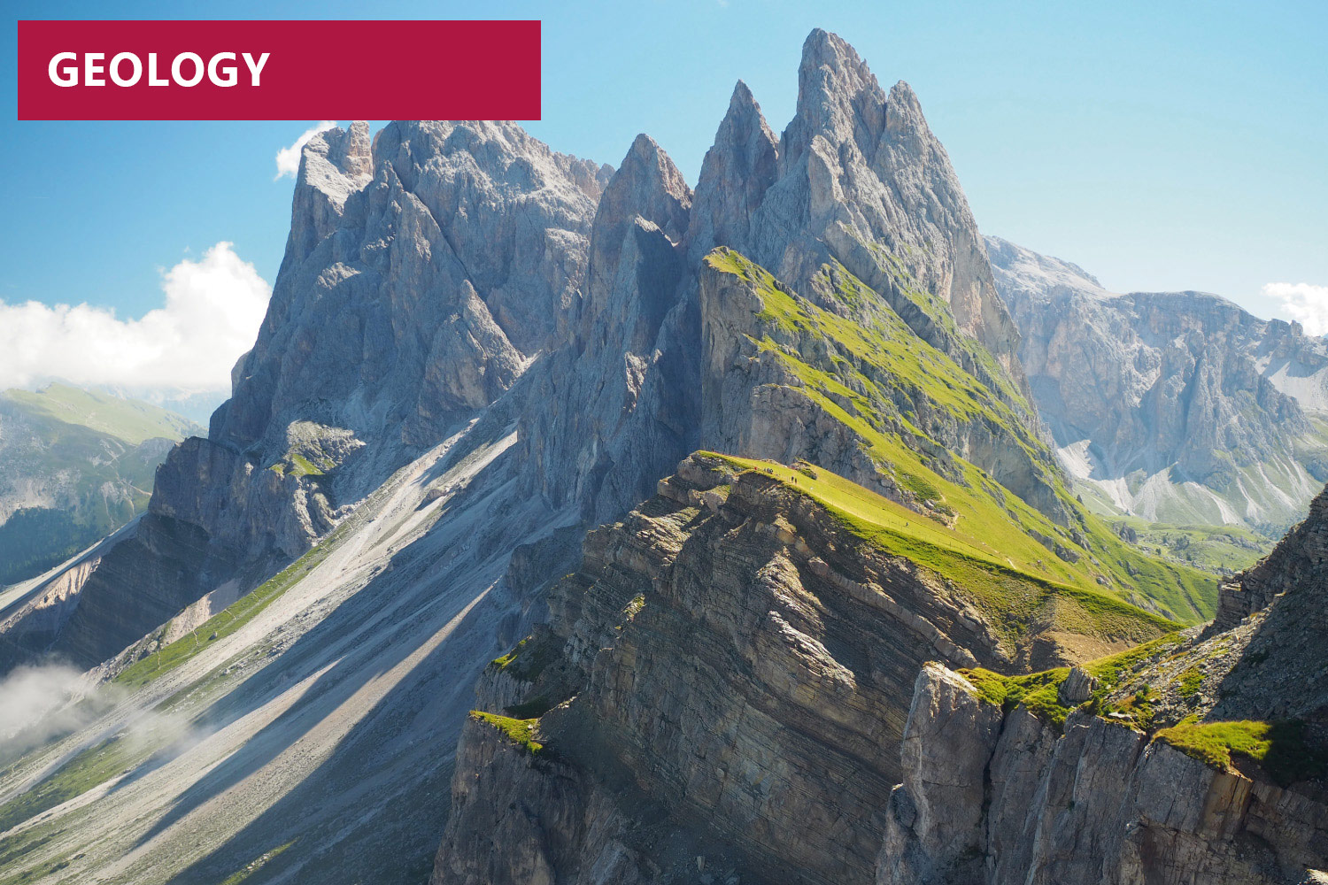
The Secëda mountain is not one of the more iconic formations of the Dolomites like the Saslong, Marmolada, Civetta or Drei Zinnen mountains, yet it is of great significance nonetheless. Thanks to this formation, the geological history of this region may be traced and reconstructed from the Upper Permian era (around 265 million years ago) to the Middle Triassic era (around 240 million years ago).
This leisurely walk starts at the most recent rocks at the peak of the Secëda, and leads - in terms of space as well as time - steadily downwards to Furnes above St. Ulrich. It begins in a sedimentation zone of a relatively deep sea with rocks around the upper terminal of the cable car. It features alkaline lavas as well as the dark limestone lying underneath, which are sometimes rich in flint from the Buchenstein formation. Up to the Pana Scharte ridge these layers of limestone are covered by the massive limestone deposits of the Schlern formation, which form the Geisler peaks and were deposited in the very shallow water of a carbonate platform.
The second part of the route follows the ski piste downhill in the direction of Furnes, where more ancient rocks may gradually be seen. Pillow lavas above the Buchenstein limestone and the Contrin formation that were deposited in very shallow water are visible. Then come the fossil-rich Werfen strata from the Lower Triassic period and the Bellerophone layers with their limestone and gypsum from the Permian era, which bear witness to the first encroachment of the sea on the area known today as the Dolomites.
The red sandstone rocks of Gröden valley may be seen in the distance, which arose from the erosion of porphyry (volcanic rock) and are clearly visible at the lower cable car terminal at St. Ulrich.